|
Trail Descriptions |
|
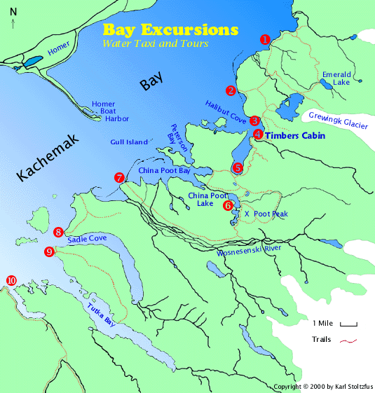
1
Humpy Creek Trail (4.0 miles/6.4 km)
Emerald Lake Trail (6.4 miles/10.2 km)
Grewingk Glacier Trail (4.1 miles/6.6 km)
You may proceed either north or south on Humpy Creek Trail.
Heading north you face a long climb up to an alpine area called
Portlock Plateau with gorgeous views of Kachemak Bay and Grewingk
Glacier. Look for black bear and mountain goats on the alpine
slopes. This trail connects to Emerald Lake Trail and eventually
Grewingk Glacier Trail so that you can loop back around to Humpy
Creek. Proceeding south, on relatively flat terrain, takes you
to the tram crossing Grewingk Creek and the Grewingk Creek Trail.
July and August brings a run of pink salmon to Humpy Creek by
the thousands. Dolly varden trout gorge themselves on pink salmon
eggs and black bear frequent the area feeding on salmon carcasses.
With all the black bears in the area one must take precautions
not to become part of the food chain. This trail head must be
accessed by boat at high tide to avoid getting wet feet. Proceeding
on the Emerald Lake Trail from the north end of the Humpy Creek
Trail brings you down to Emerald Lake and a campsite. Another
2 miles down to the Glacier Lake brings you to the trail end
at a junction with the Grewingk Glacier Trail. Take Grewingk
Glacier Trail southeast to the glacier terminus or loop around
back to the tram and Humpy Creek Trail. Map |
|
2
Glacier Lake Trail (2.2 miles/3.5 km)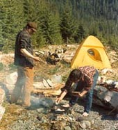
This popular loop route with the Saddle Trail offers a fairly
easy hike
across the dry outwash plain of the Grewingk Glacier to the foot
of the lake. Good camping exists near the trailhead, at Rusty's
Lagoon and also up at the lake. An excellent trail for an easy
day hike, we recommend a morning drop-off at Glacier Spit and
an afternoon pick-up at the Saddle Trail Head. If you have time
for a longer day of hiking, consider crossing the river on the
tram to go all the way to Grewingk Glacier from the Grewingk
Glacier Trail, Emerald Lake Trail and Humpy Creek Trail. Map |
|
3
Saddle Trail (1.0 mile/1.6 km)
Alpine Ridge (2.5 miles/4 km)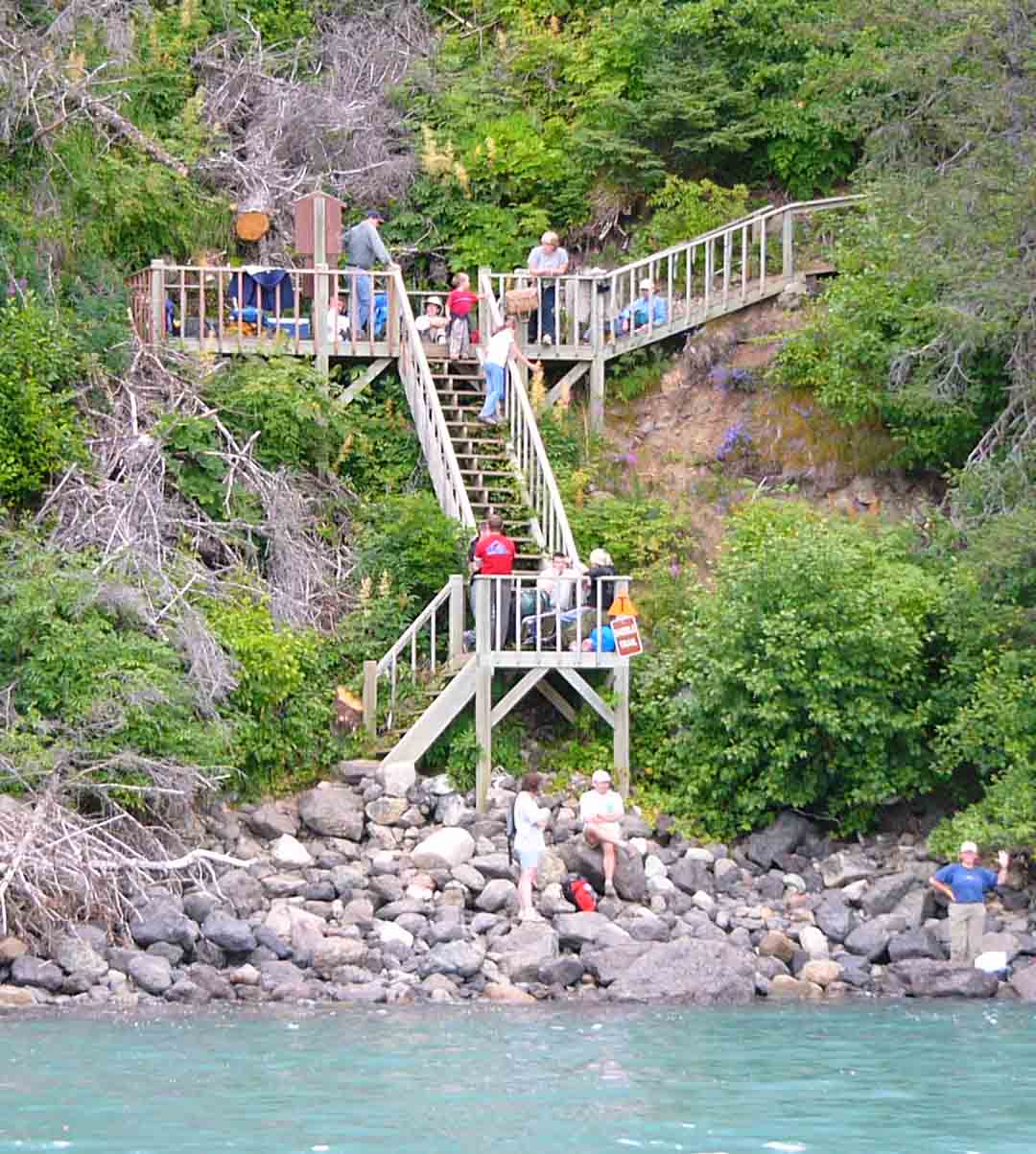
Leading over a low ridge between Halibut Cove and the Grewingk Glacier, the trail provides a popular loop with the Glacier Lake Trail. Expect a moderate climb through short switchbacks and steep forested terrain to the Glacier outwash connecting with the Glacier Lake Trail. This trail also connects to the Alpine Ridge Trail and the Lagoon Trail. It is a two hour hike to Timbers, our wilderness rental cabin, on the Lagoon Trail. Alpine Ridge Trail is a popular, quick route to alpine areas and takes off from the high point on the Saddle Trail. Our family particularly enjoys this trail in August when the blueberries are ripe. Spectacular views of Halibut Cove, Grewingk Glacier and lower Cook Inlet are to be had from the 2100-foot elevation and relatively easy access to higher ridges to the Southeast. Map |
|
4
Timbers
Wilderness Cabin
Lagoon Trail (6.2 miles/10 km)
Goat Rope Spur Trail (1.5 miles/2.4 km)
The lightly-traveled two-mile section of this heavily-forested
trail, from the Saddle Trail around Halibut Cove to the Halibut
Creek trailhead, takes you to Timbers, our wilderness rental cabin. Figure on two hours for the hike to Timbers from the Saddle Trail. Due to the recent spruce bark beetle infestation this trail has not been maintained regularly. Wind storms throughout the summer may make sections of the trail impassable. Contact Karl for up to date information on the condition of the trail. From the Halibut Creek trailhead the rest of the Lagoon Trail becomes difficult. There is no bridge across Halibut Creek, so we recommend the stream be waded at low tide out on the tidal flats where the water will be shallower. Expect knee to waist deep, ice cold, muddy and swift water. Pick up the trail again by following orange trail markers along the tidal flats. A series of steep switchbacks then leads through the spruce forest up to where the trail intersects the Goat Rope Spur Trail, a short, steep route to a 3160 foot summit with some of the finest views in Kachemak Bay. The trail continues south, across a cascading creek, more steep switchbacks, and finally takes you to the Halibut Cove Lagoon Ranger Station and Public Dock. Map |
|
5
China Poot Lake Trail (2.6 Miles/4.1
km)
Coalition Trail (1.4 miles/2.2 km)
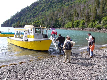
Halibut Cove Lagoon is one of the more populated areas of
the park. Here you will find a public dock, three public use
cabins and the ranger station. There is also some good king salmon
fishing in May and June. Access across the shallow entrance into
Halibut Cove Lagoon must be accomplished near high tide, so it
is good to make advance reservations. You may take three different
trails from here. The Lagoon Trail takes you on a difficult hike
along the southeast shore of the lagoon and Halibut Cove, passing
the Timbers cabin at
Halibut Creek to connect with the Saddle Trail. Two tenths of
a mile down the China Poot Lake trail will bring you to the start
of the Coalition trail which climbs over a low ridge, offering
good views of China Poot Bay before dropping down to the head
of the bay. Continuing on the China Poot Lake trail takes you
over another low ridge passing two small lakes to China Poot
Lake and the base of Poot Peak. There are campgrounds and a public
use cabin at the lake. Map |
|
6
Poot Peak Trail (4.6 miles/7.4 km)
Wosnesenski Trail
With several camp sites and a cabin, China Poot Lake makes
for a good jumping off place for the ambitious hiker wanting
to climb Poot Peak. Affectionately called "Chocolate Drop"
by the locals, this notable landmark (featured on our home
page photo) challenges most hikers with a very steep, rocky
climb to the 2600 foot summit. It is recommended that only trained
rock climbers continue beyond the 2100-foot level of the peak.
You will be rewarded with some of the finest scenery on the parks
trail system along the southern portion of the trail. The Wosnesenski
Trail is also accessed from China Poot Lake. 7 This trail was recently extended
from its terminus with the Wosnesenki River Valley to follow
the river downstream nine miles to a trailhead on the McKeon
River Flats near a landmark rock called Haystack. Map |
|
8
Sadie Knob Trail (3 miles/4.8 km)
Recently completed, this trail winds its way through spruce
forests to the alpine areas of Sadie Knob with outstanding views
of Sadie Cove and Kachemak Bay. Watch for mountain goats to the
south. Map |
|
9
Grace Ridge (2.8 miles/4.5 km to the
top; trail continues several miles further)
This trail follows the ridge that divides Sadie Cove and Tutka
Bay. Depending on the weather and water conditions, access to
this trail can be from the mouth of Tutka Bay at the Kayak Beach
trailhead, or from the gravel pit on the Sadie Cove side. It
climbs up through the rain forest till it reaches the alpine
meadows 3000 feet above the bay. There are spectacular views
in all directions. Following the trail along the ridge brings
you to its southern terminus halfway down Tutka Bay and directly
across from the Sea Star Public use cabin. Map |
|
10
Jakolof Bay Public Dock
Although not within the boundaries of the State Park, Jakolof
Bay is a great place to bring your mountain bike. You may go
west and take a seven mile maintained gravel road into Seldovia,
or head south on an old logging road all the way to Rocky River
on the Gulf of Alaska. This road is washed out in numerous spots
and there are some streams to ford. Plan on more than a day to
go clear to the Gulf and return. Map |